Introduction to new GeoSPARQL features with Apache Jena
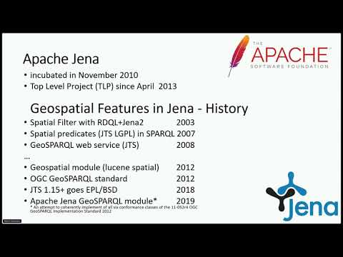
summary
Apache Jena adds a GeoSPARQL module that implements OGC conformance classes, supports WKT and GML, and plugs into Apache SIS to transform spatial reference systems on the fly. A Fuseki server build and a Java library are provided. Integration uses JTS for geometry ops. Compliance benchmark runs 206 queries and returns 177 correct answers for an overall 82.75% compliance. Known gaps: empty-geometry/boundary edge cases and some distance/non-topological functions; raster and 3D features are planned.
AI-written summary · about
chapters (10)
- 0:00Introduction to talk
- 1:35Speaker introduction
- 3:44Apache Jena and GeoSPARQL overview
- 10:12OGC GeoSPARQL standard explained
- 18:48Apache Jena GeoSPARQL module demo
- 23:25Standalone GeoSPARQL server setup
- 26:18Standards compliance and benchmark
- 29:47Future features and improvements
- 31:14Acknowledgments and closing
- 32:16Q&A session
related talks
 22mApache SIS library for geospatial applications
 19mTerriaJS: An open-source framework for 3D geospatial data...
 44mHow to use Geospatial Data in SQL Server
 42mIntroduction to the Semantic Web
 17mWho actually uses geospatial data?
 50mGeospatial Analysis
 22mTake your Business to a New Geography
 31mUnpacking the geospatial engineering toolbox – an overview of data science techniques for spatial da