Geospatial Machine Learning at Scale

summary
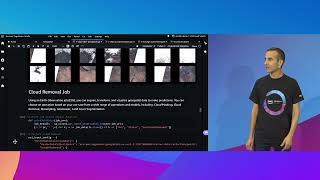
Amazon SageMaker adds geospatial connectors for Sentinel‑2, Landsat and OpenStreetMap, a notebook SDK to launch managed processing jobs (demo job returns 25 scenes and typically completes in ~20 minutes), built‑in ops like resampling and geomosaic, a cloud removal model that masks and fills clouds, and ready transformations to compute NDVI time‑lapse stored to S3. The demo runs an NDVI pipeline over a Brazil AOI, exports a time series and area measurements, and produces a clear time‑lapse showing steady loss of greenness over several years.
AI-written summary · about
chapters (7)
- 0:00Geospatial ML introduction
- 3:26Geospatial data challenges
- 8:44SageMaker geospatial features
- 13:03Demo: Raw materials monitoring
- 20:31Deforestation analysis with NDVI
- 21:56Resources for geospatial ML
- 23:21Q&A
related talks
 48mAccelerate science, research, and innovation with AWS
 26mEarthquake damage mapping with Amazon SageMaker geospatial
 19mUsing Amazon SageMaker to develop and deploy ML models
 31mFrom Radar Echoes To Real-Time Recognition: Deep Learning on Another Planet -An Open Source Workflow
 01h 36mFrom Maps to Models: An End-to-End Journey in Geospatial Machine Learning with Python
 21mAWS On Air ft. Amazon SageMaker Ground Truth Plus
 37mStreamlining Machine Learning Operations
 17mFree satellite imagery and DEM analyses enabling NRM in the developing world